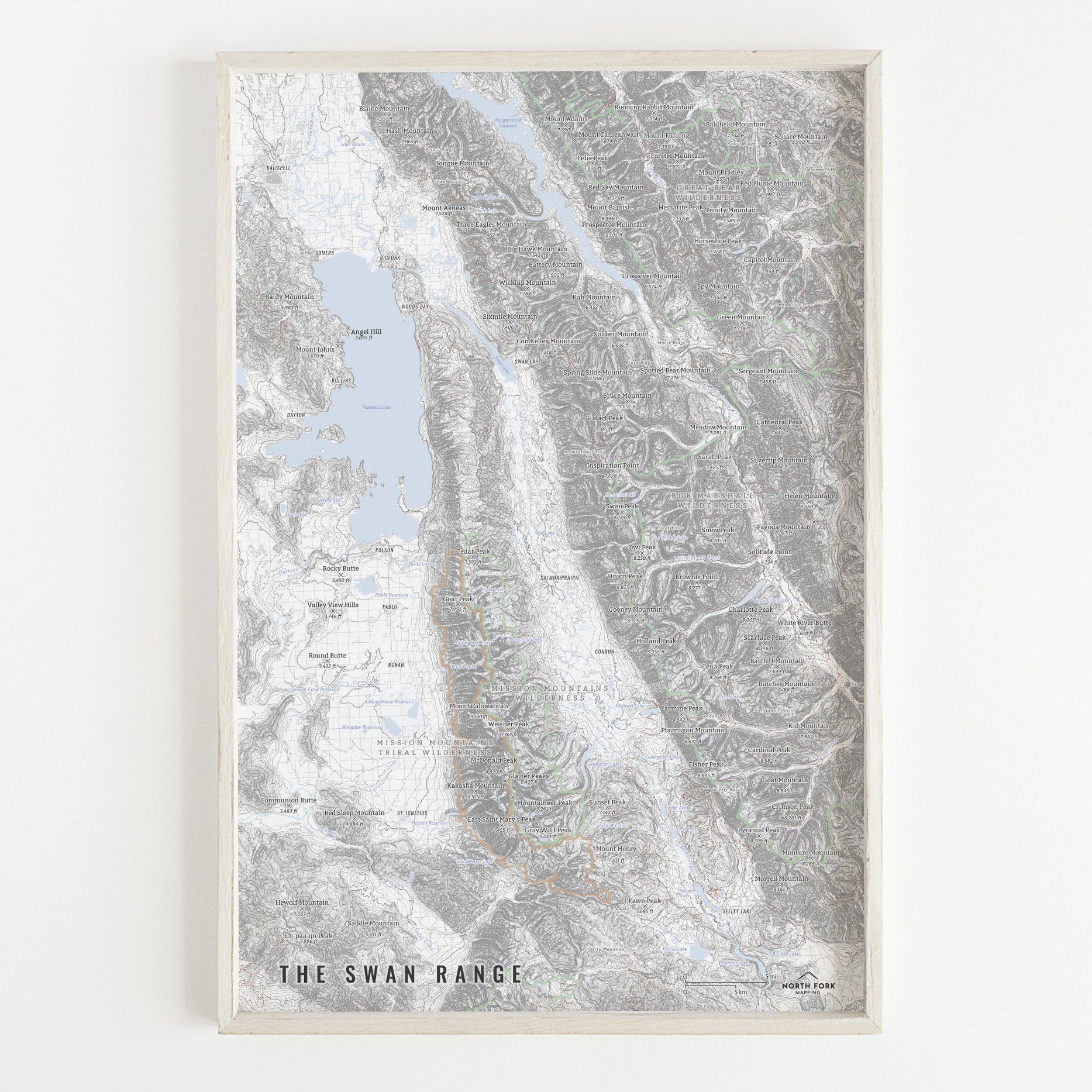
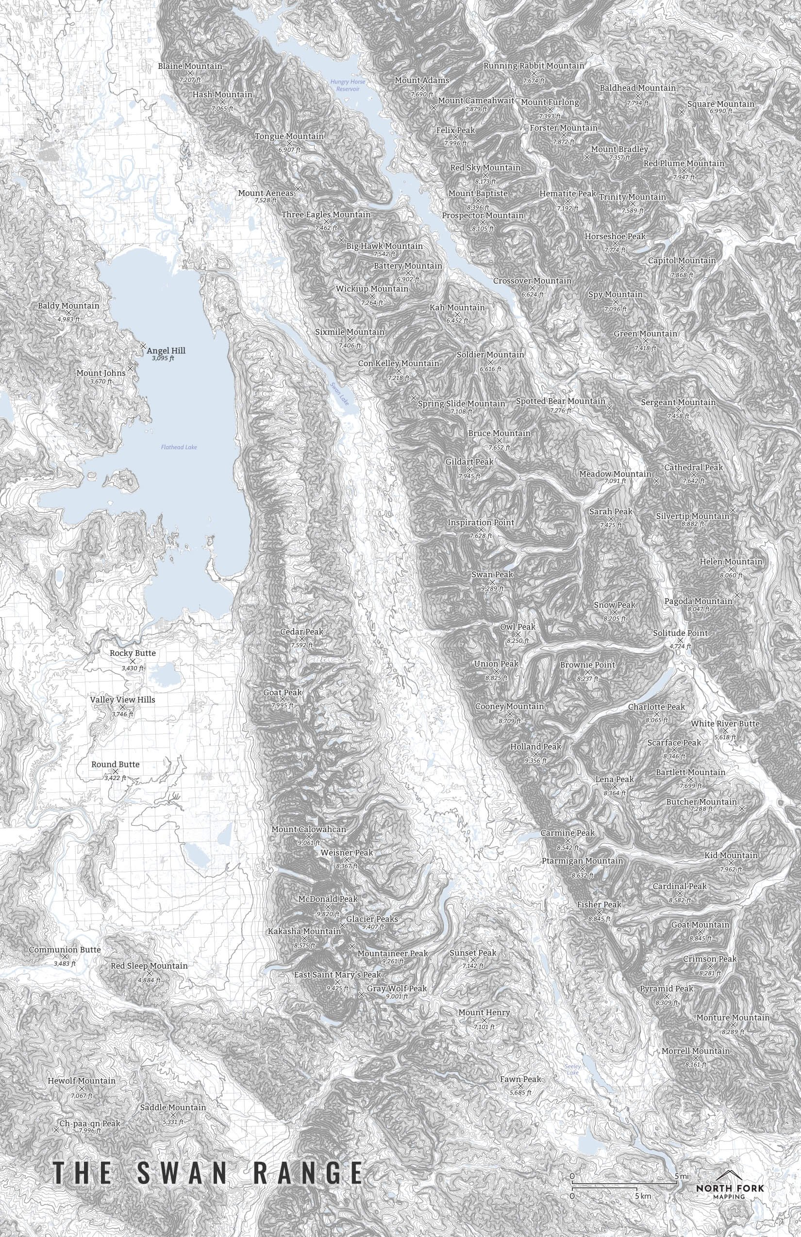
Regional Map - Southwest Montana - Boulder to The Crazies to West Yellowstone
A map of southwest Montana. A hillshade background with mountain summits, lakes, shaded NPS and USFS lands and glaciers are all a prominent feature on this map. This map stretches from Boulder, MT and Canyon Ferry Lake to the NW, The Crazies to the NE, Lamar Valley to the SE, and the Gravellys and West Yellowstone to the SW. Due to the level of detail, this map is available in one size - 24”x30””
See below for descriptions on our three signature styles.
Prints are shown framed for display purposes only.
Map of the Absaroka Beartooth Wilderness!
We have three signature styles of map depending on what you’re looking for:
“Minimalist” - This map has the title and hillshade as well as hydrology, glaciers, and a faint road network for reference. Clean, simple, elegant. More of an “art” look than a “map” look.
“Just The Basics” - Adding onto the minimalist style with NPS and USFS shading as well as mountain summits. A basic map.
“All The Things” - Just as it sounds. The mappiest of them all. Adds in town names, trails, common place names, state boundary and labels, glacier labels, labels for mountain ranges and NPS, stream and lake labels.