Skip to Content
North Fork Mapping
Home
Shop Maps
Custom Maps
Stockists
Wholesale
About
FAQs
Artist Resources
Contact
Follow us on Instagram
Follow us on Facebook
0
0
North Fork Mapping
Home
Shop Maps
Custom Maps
Stockists
Wholesale
About
FAQs
Artist Resources
Contact
Follow us on Instagram
Follow us on Facebook
0
0
Home
Shop Maps
Custom Maps
Stockists
Wholesale
Folder: About
Back
FAQs
Artist Resources
Contact
Follow us on Instagram
Follow us on Facebook
Shop Maps Seeley Lake
SeeleyLakeMap_NorthForkMapping.jpg Image 1 of 4
SeeleyLakeMap_NorthForkMapping.jpg
SeeleyLake.JPG Image 2 of 4
SeeleyLake.JPG
SeeleyLake_all_11x17-01.jpg Image 3 of 4
SeeleyLake_all_11x17-01.jpg
SeeleyLake_min_11x17-01.jpg Image 4 of 4
SeeleyLake_min_11x17-01.jpg
SeeleyLakeMap_NorthForkMapping.jpg
SeeleyLake.JPG
SeeleyLake_all_11x17-01.jpg
SeeleyLake_min_11x17-01.jpg

Seeley Lake

from $34.00

Seeley Lake is flanked by the Mission and Swan Mountains. The map includes the bathymetry of Seeley Lake, depicting the depths of the lake as well as the town of Seeley Lake and the trails to the east.

See below for descriptions on our three signature styles [only two available on this map due to the data].

Map customization available on request.

Size:
Style:
Quantity:
Add Seeley Lake Map to Cart

Seeley Lake is flanked by the Mission and Swan Mountains. The map includes the bathymetry of Seeley Lake, depicting the depths of the lake as well as the town of Seeley Lake and the trails to the east.

See below for descriptions on our three signature styles [only two available on this map due to the data].

Map customization available on request.

Seeley Lake!

We have three signature styles of map depending on what you’re looking for [two for this map]:

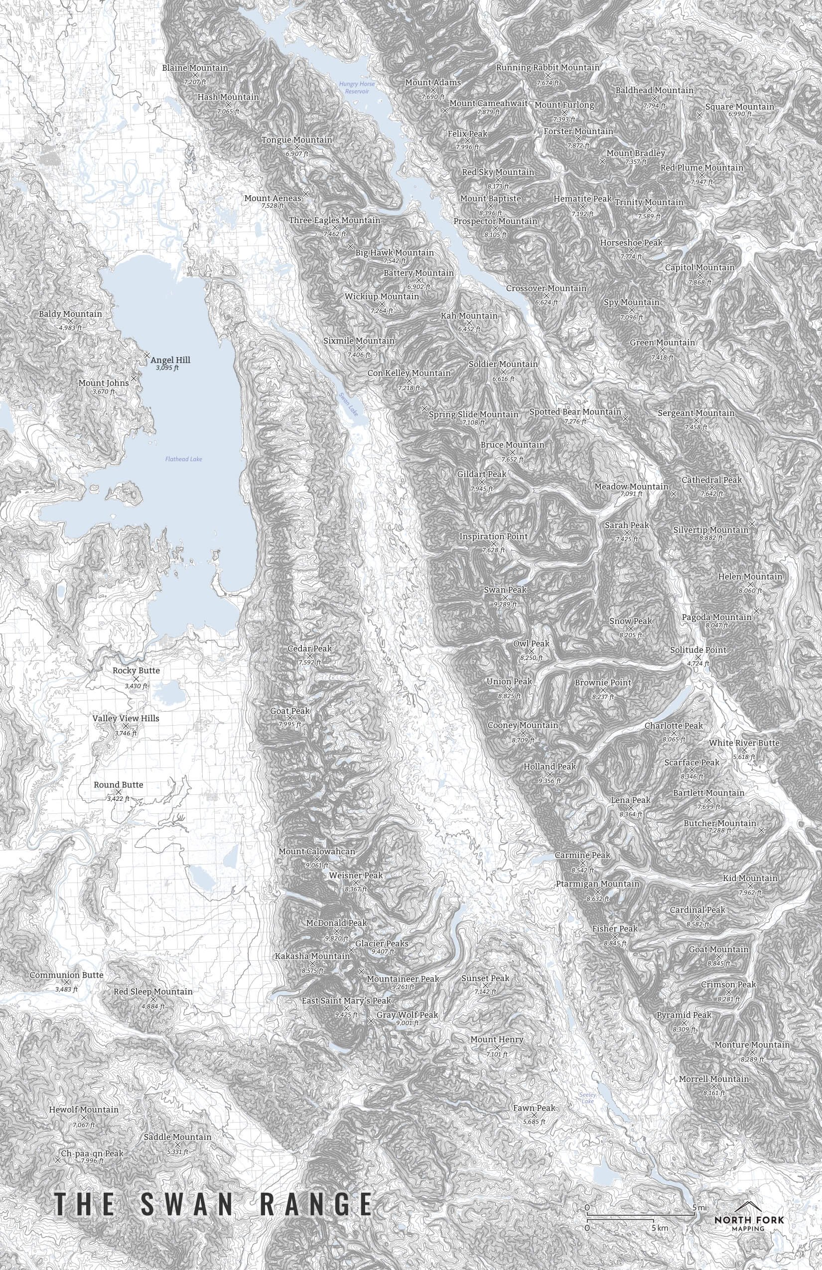
“Minimalist” - Title and topo lines with a very faint road network underneath for reference as well as hydrology. Clean, simple, elegant. More of an “art” look than a “map” look.

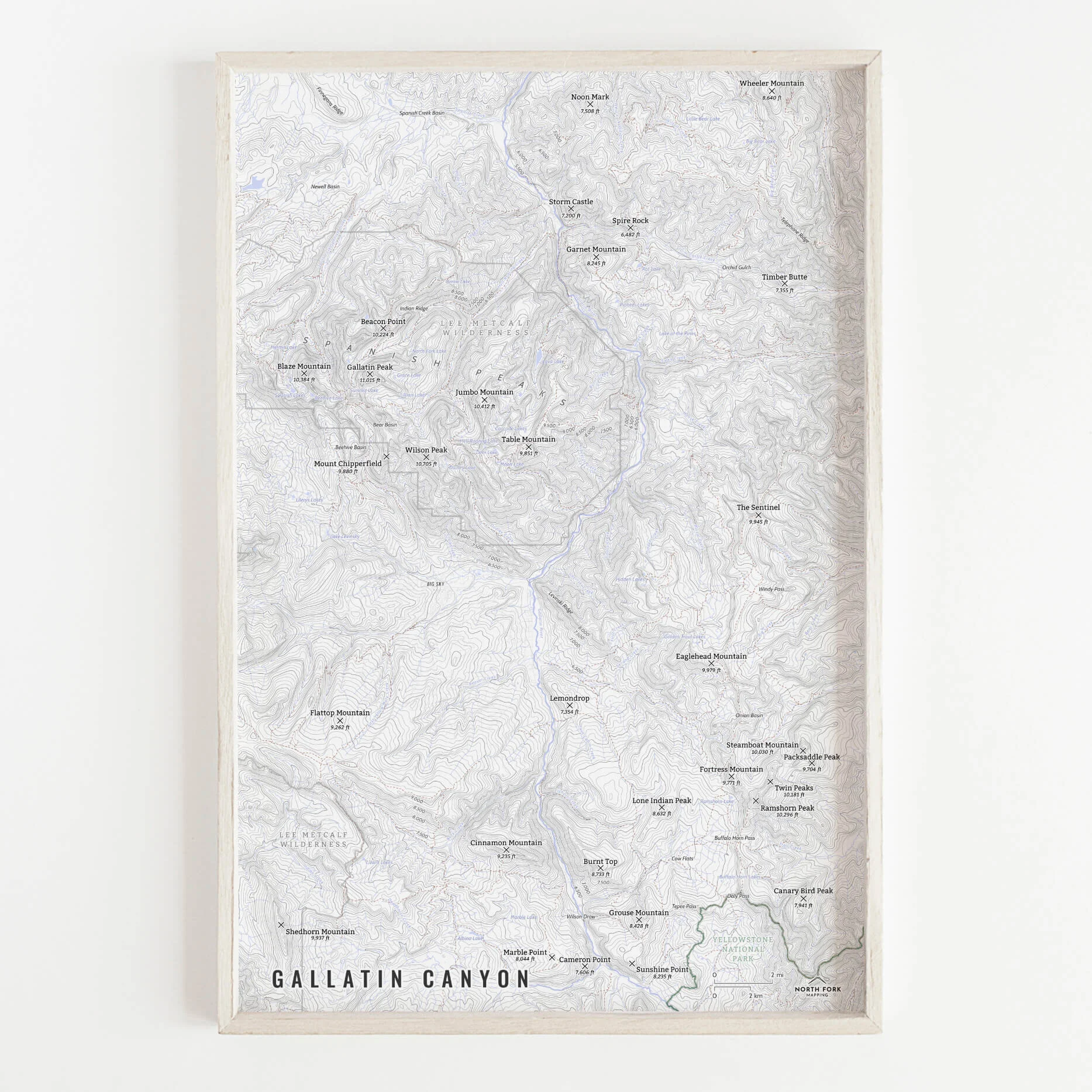
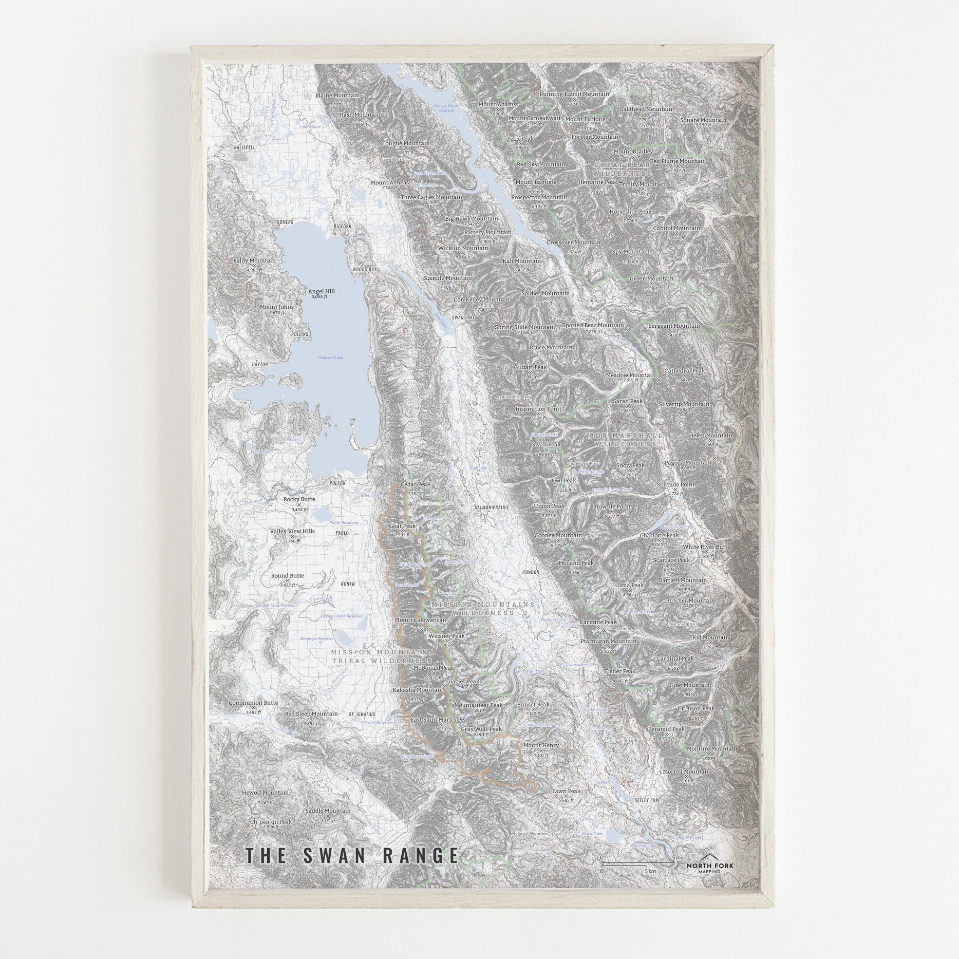
“All The Things” - Just as it sounds. The mappiest of them all. Adding common place names, lake labels, stream labels, trails, town labels, and other elements.

You Might Also Like

West Highland Way - Scotland WestHighlandWayMap_Screenshot.JPG WestHighlandWayMap_Screenshot2.JPG Scotland_WestHighlandWay_allthethings_16x20-01.jpg Scotland_WestHighlandWay_basics_16x20-01.jpg Scotland_WestHighlandWay_min_16x20-01.jpg
West Highland Way - Scotland
from $34.00
Batch of 10 Postcards
$25.00
The Swans SwanRange_all_11x171-01.jpg SwanRange_basics_11x17-01.jpg SwanRange_min_11x17-01.jpg
The Swans
from $34.00
Cascade Range [Central Oregon] CascadesMap_MtBachelor_MtJefferson_16x20_all-01.jpg CascadesMap_MtBachelor_MtJefferson_16x20_basics-01.jpg CascadesMap_MtBachelor_MtJefferson_16x20_min-01.jpg CascadesMap_CentralOregon_Zoom.JPG
Cascade Range [Central Oregon]
from $46.00
Gallatin Canyon IMG_0685.jpg IMG_0686.jpg GallatinCanyon_11x17_allthethings-01.png GallatinCanyon_11x17_basics-01.png GallatinCanyon_11x17_minimalist-01.png IMG_0684.jpg GallatinCanyon.jpg
Gallatin Canyon
from $8.00

NORTH FORK MAPPING

COPYRIGHT © 2020-2025, NORTH FORK MAPPING, LLC

Frequently Asked Questions

Contact Us

NFM_Main logo b+w_smaller.jpg